Why in News?
The Union Ministry of Environment, Forest and Climate Change has reissued the draft notification proposing an Eco-Sensitive Area across the Western Ghats for the seventh time. The earlier draft lapsed without finalisation. The new draft keeps the matter open for public objections for 60 days. The main issue is the continuing disagreement between the Centre and the six Western Ghats States over which villages and regions should be included within the proposed eco-sensitive area.
Key Highlights of the 7th Draft Notification on Western Ghats ESA
The 7th draft notification seeks to create a legally regulated Eco-Sensitive Area across parts of the Western Ghats while balancing conservation needs with local livelihood concerns.
1. Geographical Coverage
The proposed ESA covers 56,825.7 sq. km across six Western Ghats States. Karnataka has the largest proposed area, while Gujarat has the smallest.
| State | Proposed ESA Area |
| Karnataka | 20,668 sq. km |
| Maharashtra | 17,340 sq. km |
| Kerala | 9,993.7 sq. km |
| Tamil Nadu | 6,914 sq. km |
| Goa | 1,461 sq. km |
| Gujarat | 449 sq. km |
2. Activities Proposed to be Prohibited
The draft proposes a complete ban on high-impact and ecologically harmful activities such as commercial mining, stone quarrying, sand mining, new thermal power plants, red-category polluting industries and large construction projects.
3. Activities to be Regulated or Protected
Hydel power projects will not be fully banned but will be strictly regulated. The notification also clarifies that agriculture, plantation activities and day-to-day livelihood practices of local communities will remain unaffected.
4. Phased Implementation Option
The draft allows phased notification of the ESA on a State-wise or combined basis. This means the Centre may proceed with notification even if complete consensus among all six States is not immediately achieved.
5. Committee to Examine State Objections
An expert committee formed in 2022 is examining objections raised by States, especially regarding village names, boundary errors and area demarcation. Its tenure has been extended till July 2027.
About Western Ghats:
- The Western Ghats, also known as the Sahyadri Hills, run parallel to India’s western coast. They extend from the Satpura Range in the north through Maharashtra, Goa, Karnataka, Kerala and Tamil Nadu, ending near Kanyakumari.
- The range is called Sahyadri in northern Maharashtra, Sahya Parvatham in Kerala, and Nilgiri Malai in parts of Tamil Nadu.
Coastal and Foothill Regions
- The northern coastal plain between the Western Ghats and Arabian Sea is called the Konkan Coast.
- The central coastal part is called Kanara.
- The southern coastal part is called the Malabar Coast.
- The eastern foothill region in Maharashtra is called Desh.
- The eastern foothill region in central Karnataka is called Malanadu.
Geological Features
There are two major views on the geology of the Western Ghats:
- They are treated as block mountains formed due to down-warping of land towards the Arabian Sea.
- They are also described as the faulted edge of the Deccan Plateau, not true fold mountains.
Major rocks found in the region include basalt, charnockites, granite gneiss, khondalites, metamorphic gneisses, crystalline limestone, iron ore, dolerites and anorthosites.
Important Passes in Western Ghats
Passes are important for transport, trade and connectivity between the western coastal plain and the interior plateau.
| Pass | Connectivity |
| Thal Ghat / Kasara Ghat | Connects Mumbai to Nashik |
| Bhor Ghat | Connects Mumbai to Pune via Khopoli |
| Palakkad Gap / Palghat Gap | Connects Coimbatore in Tamil Nadu to Palakkad in Kerala |
| Amba Ghat | Connects Ratnagiri district to Kolhapur |
| Naneghat Pass | Connects Pune district with Junnar |
| Amboli Ghat Pass | Connects Sawantwadi in Maharashtra to Belgaum in Karnataka |
Among these, the Palakkad Gap is especially significant because it is a major break in the Western Ghats and links Kerala with Tamil Nadu.
Protected Area and Eco-Sensitive Zone
A Protected Area is a legally protected conservation space such as a national park, wildlife sanctuary or tiger reserve. An Eco-Sensitive Zone acts as a buffer around such protected areas to reduce ecological pressure.
| Feature | Protected Area | Eco-Sensitive Zone |
| Purpose | Strict biodiversity conservation | Buffer protection around protected areas |
| Protection Level | Highest protection | Regulated protection |
| Activities | Highly restricted | Harmful activities restricted; sustainable practices allowed |
| Livelihoods | Often more restricted | Traditional livelihoods may continue |
| Role | Core conservation area | Shock absorber around core areas |
This distinction is important because many State concerns arise from the fear that ESA rules may affect farming, plantations and local livelihoods.
Evolution of Western Ghats ESA Proposal
The Western Ghats conservation debate began after the Western Ghats Ecology Expert Panel, headed by Madhav Gadgil, submitted its report in 2011.
Gadgil Committee, 2011
- The committee recommended treating the entire Western Ghats as ecologically sensitive. It suggested three graded zones: ESZ-I, ESZ-II and ESZ-III, based on ecological sensitivity. States opposed the report because it was seen as too restrictive.
Kasturirangan Committee, 2013
- The committee proposed a more limited approach. It recommended that about 37% of the Western Ghats, around 60,000 sq. km, should be notified as an ESA.
- Since 2014, draft notifications have been issued repeatedly, but a final notification has been delayed due to disagreements with States.
Why States are Opposing
The six Western Ghats States have expressed concerns about the impact of ESA notification on:
- agriculture
- plantations
- housing and local construction
- infrastructure projects
- livelihood security
- village-level development planning
The main dispute is over demarcation. States have objected to the names, boundaries and areas of villages proposed for inclusion. An expert committee constituted in 2022 is examining these objections.
Ecological and Economic Importance
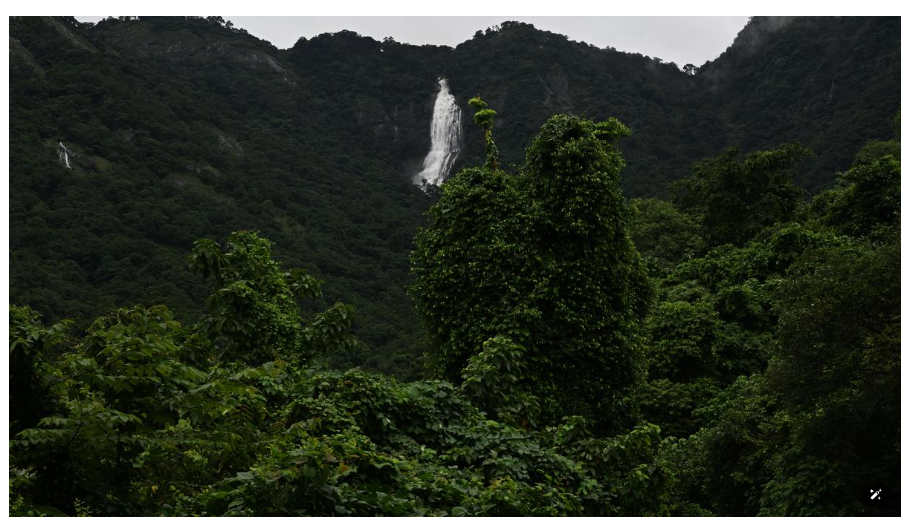
The Western Ghats are recognised as a UNESCO World Heritage Site and are among the world’s eight hottest hotspots of biological diversity.
1. Monsoon Regulation
The Ghats intercept moisture-laden southwest monsoon winds from the Arabian Sea and influence rainfall patterns across peninsular India.
2. River Systems
They form the major watershed of peninsular India.
West-flowing rivers: Periyar, Bharathappuzha, Netravati, Sharavathi, Mandovi
These are short, swift and steep-gradient rivers with hydroelectric potential.
East-flowing rivers: Godavari, Krishna, Kaveri, Tunga, Bhadra, Bhima, Malaprabha, Ghataprabha, Hemavathi and Kabini
These rivers support irrigation, agriculture and drinking water needs.
3. Biodiversity and Endemism
The region has rich tropical evergreen forests and is home to many endemic species such as Nilgiri Tahr and Lion-tailed Macaque.
It supports globally threatened plants, mammals, birds, amphibians, reptiles and fishes. Species such as Asian Elephant, Gaur, Tiger, Nilgiri Langur and Lion-tailed Macaque make the region ecologically significant.
4. Livelihood and Economy
The Western Ghats support agriculture, plantations, non-timber forest produce, hydropower, tourism and forest-dependent livelihoods. They also contain minerals such as iron ore, manganese and bauxite, which explains the pressure from extractive industries.
Key Challenges
1. Centre-State Deadlock
The Centre seeks ecological protection, while States fear economic and livelihood restrictions.
2. Boundary Demarcation Issues
Village boundaries, satellite-based mapping and ground realities do not always match.
3. Regulatory Uncertainty
Repeated draft notifications without finalisation create confusion and weaken enforcement.
4. Development Pressure
Mining, quarrying, roads, construction and linear infrastructure continue to fragment fragile landscapes.
5. Conservation Cost
States often bear the political and economic cost of conservation without adequate compensation.
Way Forward
1. Field-Based Demarcation
ESA boundaries should be finalised using satellite data, field verification and village-level consultation.
2. Cooperative Federalism
The Centre and States must resolve differences through transparent dialogue instead of repeated draft extensions.
3. Livelihood-Sensitive Regulation
Traditional agriculture, plantations and local livelihoods should be clearly protected, while high-impact activities must be restricted.
4. Ecological Fiscal Transfers
States conserving fragile ecosystems should receive financial incentives for protecting national ecological assets.
5. Sustainable Local Economy
Eco-tourism, agro-ecology, non-timber forest produce and community conservation can reduce opposition to ESA rules.
6. Strict Control of High-Impact Activities
Mining, quarrying, polluting industries and unregulated construction must be regulated through strong enforcement.
Conclusion
The Western Ghats are not only a mountain chain but a critical ecological system that regulates monsoon, sustains rivers, protects biodiversity and supports millions of livelihoods. The repeated delay in finalising the ESA notification shows the difficulty of balancing conservation with development. The solution lies in a scientific, federal and livelihood-sensitive approach, where fragile ecosystems are protected without ignoring local communities.