Table of Contents
Relevance: GS Paper I – Geography | GS Paper III – Environment, Water Resources, Disaster Management
For Prelims:
River Basin Management Scheme, Ministry of Jal Shakti, National Water Development Agency (NWDA), Interlinking of Rivers (ILR), Brahmaputra Board, Central Water Commission (CWC), LiDAR, Springshed Management, Indus Basin, Brahmaputra Basin
For Mains:
integrated water governance, basin-level planning, hydrological unit, inter-state water disputes, climate resilience, flood management, groundwater sustainability, ecological balance, water security, river basin approach
Why in News?
- The Government of India has approved the continuation of the River Basin Management (RBM) Scheme for the period 2026–27 to 2030–31 with an increased financial outlay of ₹2,183 crore.
- The previous cycle had an outlay of ₹1,276 crore, showing a major expansion in funding and strategic importance.
- The renewed scheme focuses on scientific planning, inter-basin coordination, flood control, groundwater sustainability, and strengthening India’s long-term water security.
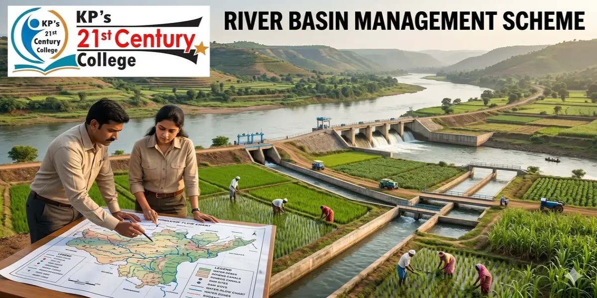
What is the River Basin Management (RBM) Scheme
- The River Basin Management Scheme is a scientific and institutional framework under the Ministry of Jal Shakti for the integrated management, protection, and sustainable development of India’s river basins.
- Instead of treating rivers as isolated water channels, the scheme views the entire river system—including tributaries, floodplains, groundwater, wetlands, and ecological zones—as a single hydrological unit.
- This marks a shift from project-based water governance toward basin-level planning where irrigation, hydropower, drinking water, navigation, ecology, and disaster management are handled together.
- It promotes sustainable use of water resources while balancing developmental and environmental priorities.
Why Basin-Level Water Governance is Necessary
- India has only about 4% of the world’s freshwater resources but supports nearly 17% of the global population, making efficient water governance essential.
- Rapid urbanisation, industrial expansion, and agricultural demand have increased pressure on rivers and groundwater reserves.
- Climate change has intensified floods, droughts, erratic monsoons, glacial melt, and riverbank erosion, making traditional fragmented planning inadequate.
- River systems such as the Indus and Brahmaputra also have international strategic importance, requiring basin-level data for water diplomacy and national security.
- Localized project-based planning often ignores upstream-downstream interdependence, causing ecological degradation and inefficient water use.
Key Features of the RBM Scheme
Integrated Basin Planning
- The scheme provides for preparation and periodic revision of Master Plans for major river basins.
- These plans identify long-term requirements related to irrigation, flood control, hydropower generation, inland navigation, drinking water supply, and ecological restoration.
- This helps in coordinated development rather than isolated departmental planning.
Scientific Survey and Investigation
- The scheme uses GIS, remote sensing, hydrological modelling, LiDAR surveys, and drone-based mapping for accurate basin assessment.
- These technologies improve preparation of Feasibility Reports and Detailed Project Reports (DPRs) for multipurpose river projects.
- Accurate terrain mapping also improves flood forecasting and sediment management.
Flood and Erosion Control
- Special attention is given to flood-prone and erosion-prone regions, especially in the North Eastern States and the Brahmaputra basin.
- Projects include anti-erosion works, raised flood shelters, embankment strengthening, and protection of vulnerable zones such as Majuli Island in Assam.
- Drainage development in Himalayan foothills also helps reduce chronic waterlogging.
Springshed Management
- In hilly and tribal areas, especially in the North East, the scheme promotes rejuvenation of natural springs through springshed management.
- This improves water availability during dry seasons and supports local livelihoods dependent on springs.
- Traditional indigenous water conservation methods are also encouraged.
Community-Based Participation
- The scheme recognises that long-term water governance requires local participation.
- Tribal communities, farmers, and local institutions are encouraged to participate in conservation, monitoring, and maintenance.
- This improves sustainability and reduces dependence only on top-down engineering solutions.
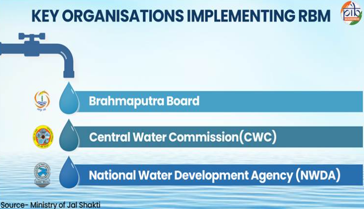
Institutional Framework for River Basin Management
Ministry of Jal Shakti
- It is the nodal ministry responsible for water resources, river development, and Ganga rejuvenation.
- It coordinates policy planning and implementation of national river basin programmes.
Central Water Commission (CWC)
- It is the premier technical organisation dealing with water resources planning, flood forecasting, irrigation, and hydrological studies.
- It supports basin planning and technical investigations.
National Water Development Agency (NWDA)
- It is responsible for planning and execution of river interlinking projects and water balance studies across basins.
- It plays a central role in inter-basin water transfer proposals.
Brahmaputra Board
- It focuses on flood control, drainage development, and anti-erosion measures in the Brahmaputra and Barak valleys.
- Its role is especially important for the North Eastern region.
Major Challenges in Water Governance
- Inter-state disputes over river water sharing continue to delay implementation of basin plans and transfer projects.
- Examples such as Cauvery, Krishna, and Ravi-Beas disputes show how political friction affects water governance.
- Remote terrain in Jammu and Kashmir and the North East causes logistical difficulties and short working seasons, delaying project execution.
- Historically, lack of real-time hydrological data has weakened accurate streamflow prediction and flood management.
- Large infrastructure projects such as dams and diversion canals can disturb ecosystems, fish migration, wetlands, and biodiversity.
- High costs of anti-erosion works in rivers like the Brahmaputra often exceed original estimates, creating fiscal pressure.
Significance for India
- RBM strengthens national water security by ensuring scientific planning of limited freshwater resources.
- It improves agricultural productivity by supporting irrigation expansion and groundwater recharge.
- Flood management reduces disaster losses and protects vulnerable populations in riverine areas.
- River basin planning supports energy security through hydropower development and navigation infrastructure.
- Strategically important river systems like the Indus and Brahmaputra gain stronger hydrological assessment for cross-border negotiations.
- It also supports inclusive development by improving water access in tribal and remote regions.
Way Forward
- Modern technologies such as LiDAR, drone surveys, and SCADA systems should be expanded for high-resolution basin monitoring and real-time flood forecasting.
- Capacity building of state-level technical officers must be strengthened through institutions like NEHARI and other hydrological training centres.
- Springshed rejuvenation should become a priority for North Eastern and Himalayan regions where natural springs are the primary water source.
- Better coordination among the CWC, NWDA, Brahmaputra Board, and State Governments is essential for faster DPR preparation and execution.
- Ecological sustainability must remain central so that infrastructure development does not destroy long-term river health.
- Local communities should be treated as partners rather than only beneficiaries in water governance.
Conclusion
The River Basin Management Scheme represents a major shift from fragmented water management to scientific and integrated river governance.
In a climate-stressed and water-scarce future, basin-level planning is not merely an administrative reform but a strategic necessity for national security and economic stability.
Its success will depend on balancing engineering solutions with ecological sustainability and community participation.
CARE MCQ
Q.With reference to the River Basin Management (RBM) Scheme, consider the following statements:
- It treats an entire river system including tributaries and groundwater as a single hydrological unit.
- The National Water Development Agency is responsible for Interlinking of Rivers projects.
- The Brahmaputra Board primarily deals with coastal erosion management in peninsular India.
Which of the statements given above are correct?
A. 1 and 2 only
B. 2 and 3 only
C. 1 and 3 only
D. 1, 2 and 3
Ans: (a)
Explanation
Statement 1 is correct: RBM follows an integrated basin approach where the full river system is treated as one hydrological unit.
Statement 2 is correct : The NWDA is the main agency for planning river interlinking projects.
Statement 3 is incorrect : The Brahmaputra Board deals mainly with flood control and erosion management in the Brahmaputra and Barak valleys of North East India.
Q.Consider the following statements regarding the Interlinking of Rivers Programme:
- It is based on the idea of transferring water from river basins with relatively higher availability to those facing water stress.
- The National Water Development Agency plays an important role in planning and feasibility studies for river linking projects.
- The Ken-Betwa Link Project represents an important project under this programme.
Which of the statements given above are correct?
(a) 1 and 2 only
(b) 2 and 3 only
(c) 1 and 3 only
(d) 1, 2 and 3
Ans: (d)
Explanation:
Statement 1 is correct: the interlinking programme is based on the principle of balancing regional water availability by transferring water from relatively surplus basins to water-deficit areas to support irrigation, drinking water, and drought mitigation.
Statement 2 is correct : the National Water Development Agency (NWDA) is the central technical body responsible for preparing feasibility reports, conducting studies, and coordinating implementation of river linking proposals.
Statement 3 is correct : the Ken-Betwa Link Project is one of the most significant and advanced projects under the river interlinking programme and is often regarded as a model for future implementation.
Q. With reference to the Brahmaputra River system, consider the following statements:
- The Brahmaputra enters India through a gorge formed near Namcha Barwa after traversing the Tibetan Plateau.
- Unlike the Indus, the Brahmaputra carries a larger volume of water and sediment due to its humid catchment in the eastern Himalayas.
Which of the statements given above is/are correct?
(a) 1 only
(b) 2 only
(c) Both 1 and 2
(d) Neither 1 nor 2
Ans: (c)
Explanation:
Statement 1 is correct: The Brahmaputra originates in southwestern Tibet and flows eastward as the Yarlung Tsangpo across the Tibetan Plateau. Near Namcha Barwa peak, it takes a dramatic U-turn called the “Great Bend” and passes through one of the deepest gorges in the world before entering India through Arunachal Pradesh as the Siang (or Dihang). This gorge is an important geomorphological feature and distinguishes the Brahmaputra from many other Himalayan rivers.
Statement 2 is correct: The Brahmaputra carries one of the highest sediment loads and water discharges amog Indian rivers. Unlike the Indus, whose basin lies largely in arid and semi-arid regions, the Brahmaputra drains the high-rainfall eastern Himalayas and Assam valley, where intense monsoonal rainfall and active erosion contribute to very high sediment transport. This is why the river is highly braided, flood-prone, and responsible for large-scale deposition in Assam and Bangladesh.
FAQs
Q1. What is the main objective of the RBM Scheme?
Its objective is to ensure integrated, scientific, and sustainable management of entire river basins for irrigation, ecology, flood control, and water security.
Q2. Which ministry implements the RBM Scheme?
The scheme is implemented under the Ministry of Jal Shakti.
Q3. What is the role of NWDA?
The National Water Development Agency plans and prepares projects related to interlinking of rivers and basin water balance studies.
Q4. Why is basin-level planning important?
Because upstream and downstream river activities are interconnected and cannot be managed effectively through isolated local projects
Q5. What is springshed management?
It is the protection and rejuvenation of natural springs and their recharge zones, especially important in hilly and tribal regions.