Landforms Created by Running Water
Rivers are one of the most dynamic agents of erosion and deposition, shaping landscapes over millions of years. They create various erosional and depositional landforms depending on their velocity, volume, and the nature of the land they traverse. These landforms evolve as rivers progress through different stages of development.
Stages of a River
Rivers pass through three primary stages as they flow from their source to their mouth. Each stage exhibits distinct erosional and depositional characteristics.
1. Upper Course (Youthful Stage)
- The river flows with high energy over steep slopes, leading to rapid erosion.
- The predominant process is downcutting or vertical erosion, deepening the river valley.
- Common landforms:
- V-shaped valleys
- Gorges and canyons
- Potholes and plunge pools
- Waterfalls and rapids
2. Middle Course (Mature Stage)
- The gradient decreases, and the river begins lateral erosion, widening the valley.
- The river meanders, forming floodplains and depositing sediments along its banks.
- Common landforms:
- Wider valleys with floodplains
- Incised or entrenched meanders
- River terraces
- Natural levees
3. Lower Course (Senile Stage)
- The river flows slowly over gentle slopes, focusing primarily on deposition.
- It develops large floodplains and extensive meanders.
- Common landforms:
- Deltas
- Oxbow lakes
- Meanders and point bars
- Back swamps and levees

Erosional Processes and Features
Rivers erode the landscape through hydraulic action, abrasion, attrition, and solution. This erosion creates various landforms, primarily in the upper and middle courses.
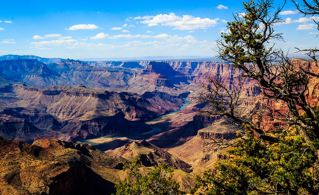
1. Valleys (V-shaped Valleys, Gorges, and Canyons)
- V-shaped valleys: Formed by vertical erosion, with steep sides and a narrow riverbed.
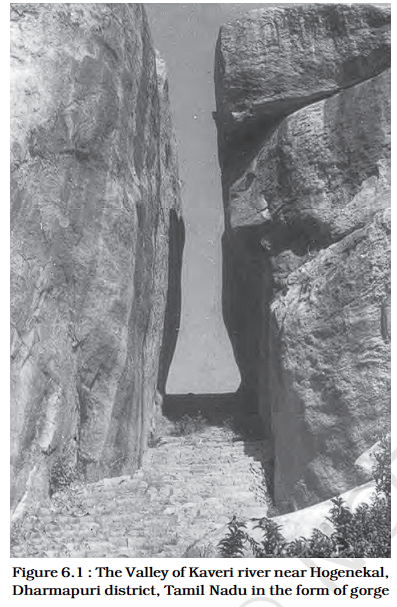
- Gorges: Deep valleys with vertical walls, usually formed by powerful river action over resistant rocks.
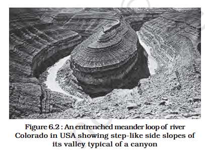
- Canyons: Similar to gorges but with step-like slopes, formed in horizontally bedded sedimentary rocks.
Example: The Grand Canyon in the USA.
2. Potholes and Plunge Pools
- Potholes: Circular holes on riverbeds created by rotating pebbles.
- Plunge pools: Deep hollows at the base of waterfalls, formed by the force of falling water and abrasion.
3. Incised or Entrenched Meanders
- Occur when rivers cut deeply into hard rocks while maintaining their meandering course.
- Formed due to tectonic uplift or increased river energy.
Example: The Colorado River meanders.
4. River Terraces
- Mark former floodplain levels, indicating a river’s previous path.
- Occur when a river cuts downward, leaving old floodplains above the current river level.
- Paired terraces appear at the same height on both sides, while unpaired terraces form on only one side.
Depositional Processes and Features
Deposition occurs when a river loses energy, dropping sediment along its course or at its mouth. This is most common in the middle and lower courses.
1. Alluvial Fans
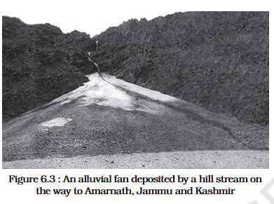
- Cone-shaped deposits of sediment formed at the base of mountains.
- Created when fast-flowing rivers enter flat plains, losing energy and dropping t
heir sediment. - Found in semi-arid and humid regions.
2. Deltas
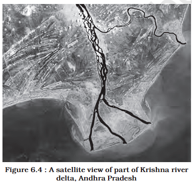
- Triangular deposits formed at the mouth of a river, where it meets a lake or sea.
- Classified into:
- Arcuate Delta (e.g., Nile Delta) – fan-shaped.
- Bird’s Foot Delta (e.g., Mississippi Delta) – river channels extend into the sea.
- Estuarine Delta (e.g., Amazon Delta) – forms within an estuary.
Example: The Ganges-Brahmaputra Delta (Sundarbans).
3. Floodplains
- Broad, flat areas adjacent to a river that are periodically flooded.
- Made of fine silt, sand, and clay deposited during floods.
- Active floodplains are frequently flooded, while inactive floodplains are at higher elevations.
4. Natural Levees
- Raised ridges of sediment along river banks, formed by repeated flooding.
- Protect against floods but can also restrict river flow, causing back swamps.
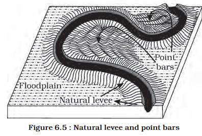
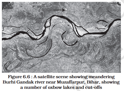
5. Point Bars and Meanders
- Meanders: Loops in a river formed due to erosion on the outer bank and deposition on the inner bank.
- Point bars: Sediment deposits on the inside bend of a meander.
- Over time, meanders can be cut off, forming oxbow lakes.
