- The area of Godavari basin is 3,12,812 Sq Km (Second largest river basin in the Country). Godavari river is
 mentioned in Puranas as Tellivaha river.
 - It is also called the River of Poets.
- It is the largest among the Peninsular rivers in terms of length, catchment area and discharge. Godavari basin drains about 10% of India’s total geographical area.
- It is the second longest river in India and the longest river in South India. Length of Godavari- 1465 Km (910 miles).
- The length of Godavari in Telangana is 560 Km. (Total length in Telangana and A.P is 772 Km).
- The state with highest catchment basin is – Maharashtra (48.6%).
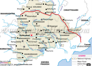
- It flows through the states of Maharashtra, Telangana, Chhattisgarh, Andhra Pradesh, Puducherry
Origin :
- Godavari river originates from a sacred pond in the Trimbakeshwar Temple on Brahmagiri mountain near Nashik in Western ghats/ Sahyadris in Maharashtra state. Elevation- 920m (3018 feet) above sea level.
Other Names: Vridha Ganga, Dakshina Ganga, Poetic river and Rhine of India.
- Annual average rainfall in its catchment area is 110 cm.
- The river island created by Godavari is Badanakurthi (Nirmal district)
- The first project built on Godavari in Telangana is Pochampadu (Sriram Sagar Projecet).
- Godavari basin is the only river basin in South India with availability of coal deposits, Godavari splits intg seven branches near Vempalli Venkatraopet village in Jagtial district.
- Godavari takes the shape of a crescent at Cheggaon village located in the border of Jagtial and Peddapalli districts.
- Godavari forms Triveni Sangamam (Confluence. three rivers) by joining with two rivers namely Manjeera and Haridra at Kandakurthi village in Renjal mandal of Nizamabad district.
- It forms another Triveni Sangamam by joining with two rivers Pranahita and Saraswati a Kaleshwaram in Bhupalpally district.
- Godavari basin is bounded on the North by the Ajanta, Nirmal, Satmala hil. and forms the Southern edge of Papi hills. The highest Peak in Godavari Basin area – Arma Konda (1 680 km).
Course of Godavari river
- It originates at Trimbakeshwar near Nashik in Brahmagirí hills in Western ghats in Maharashtra Godavari flows through Maharashtra and enters Telangana at Kandakurthi in Nizamabad district and flows through Basara in Nirmal district.
- It reaches Sriram Sagar Project (Pochampadu) after traveling along the border of Nirmal and Nizamabad districts.
- Later it crosses the districts afNizamghád, Jaetişl Mancherial, Peddnglh, Jayashankár Bhupalpally, Mulygu, Bhadradri Kothagudem and cut across Papi hills forming the Bison gorge and enters Andhra Pradesh at Polavarám (Telangana- Andhra border).
- It separates the districts of East Godavari and West Godavari. After flowing at Rajahmundry, it splits into five major branches (total 7 branches) at Dhavaleswaram and every branch joins Bay of Bengal at different places. So it is called Sapta Godavari.
Branches of Godavari
- Gowthami- Northern branch: Falls into Bay of Bengal at Yanam.
- Vasista- Middle branch. Falls into Bay of Bengal at Antarvedi.
- Vynatheya- Southern branch. Falls into Bay of Bengal at Komarigpatnam.
- Tulya- Falls into Bay of Bengal at Bendamuflanka.
- Bharadwaja- Falls into Bay of Bengal at Bendamtlanka.
- Kousika and Atreya branches join Tulya and Bharadwaja branches and flow as a single branch and fall into Bay of Bengal at Bendamurlanka. The delta region formed between CGowtami and Vasista is Konaseema. Konaseem is called as the Garden of Andhra Pradesh.
- The districts on the left side of Godavari are Nirmal, Mancherial.
The districts on the right side of Godavari are Nizamabad, Jagtial, Peddapalli, Jayashanka Bhupalapally, Mulugu, Bhadradri Kothgudem.
Discuss the river systems of Telangana, their characteristics and the inter-state water disputes involving these rivers.
| Introduction | Telangana is home to several major river systems that play a crucial role in the state’s economy, agriculture, and ecology. These rivers have distinct characteristics and have been the subject of inter-state water disputes. |
| Body | River Systems of Telangana:
Godavari River System The river Godavari rises in the Western Ghat near the Brahmagiri Hills (Triambak) in the Nasik districts of Maharahtra at an elevation of 1067 metres. After flowing south-east for approximately 1,465 km, it empties into the Bay of Bengal at Antarvedi.
Tributaries:
Telangana districts along the Godavari :
Importance :
|
Krishna River System :
Catchment area:
Tributaries :
Importance :
|
|
| Inter-State Water Disputes:
Godavari River Dispute:
Krishna River Dispute:
|
|
| Conclusion | Telangana’s river systems are vital for its development. Addressing inter-state water disputes through a combination of legal frameworks, cooperation, and sustainable water management practices is crucial for ensuring water security and the state’s long-term prosperity. |